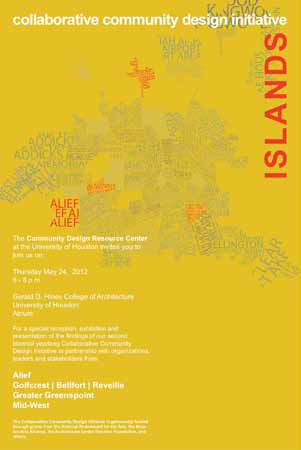
 The University of Houston’s Collaborative Community Design Initiative, which puts the spotlight on suggested improvements in Alief in 2011, has been updated with a new report released in 2013.
The International Management District Zones and Strategies report focuses on five zones within the District: West Park, Chinatown West, the Neighborhood Center Zone, the Sugar Hill Zone, and the West Belt Zone, with recommendations for improvements and new projects involving housing, economic development, and public spaces such as parks, trail networks, crosswalks, gateways, connectivity, and parking lots.
The Collaborative Community Design Initiative is a program of the University of Houston Community Design Resource Center. The center’s stated purpose is to forge partnerships between communities, faculty, students, and professionals in design planning, real estate, and community development to work for sustainable and comprehensive community change.
“We partner for a year with four neighborhoods in Houston,” said Susan Rogers, director of the center. “We document the existing conditions and opportunities, develop larger design strategies, and then we combine everything and publish it all in a book.” IMD Director of Operations Brian Burks said the District is working to reach out to developers and brokers to share the plan with them.
The report revealed that IMD had 32 active vacant properties for sale as of October 1, 2012, dispersed across the District and ranging in size from one acre to over 136 acres. Together, the properties comprise nearly 300 acres of available land. The properties range in value from $5 to $20 per square foot, with exceptions both on the low and the high ends. The combined value of this property is just under $55 million. The average price per square foot is approximately $4.25.
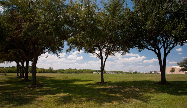
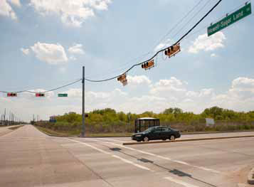 According to the report, the West Park Zone is bounded by Hwy 6 on the west, Howell Sugar Land Road on the east, Westpark on the north, and Bissonnet on the south. The area has a large concentration of vacant land and has also experienced substantial growth over the last decade. The area also has one of the highest median household incomes in the District, averaging approximately $45,000. The initiative has identified this area for development of new housing organized around new public parks and open spaces.
The Chinatown West Zone follows the Bellaire corridor from Brays Bayou west to Howell Sugar Land Road. Land values along this corridor have steadily risen over the last five years, and new development is increasing. The proposals for this area focus on building the public realm and enhancing the identity of the area, including creating small pocket parks and plazas, pedestrian bridges or gateways, new high-density mixed-use developments, and public transit, the report said.
The Neighborhood Center Zone bounded by Howell Sugar Land Road on the west, Dairy Ashford and Boone Road on the east, a major drainage easement on the north, and Beechnut and Bissonnet on the south, is a zone characterized by relatively stable single-family neighborhoods and very little vacant land. The Sugar Hill Zone is bounded by Dairy Ashford on the west, Boone Road on the east, Beechnut on the north, and the District boundaries on the south. The center of opportunity in this zone is the former Sugar Hill Golf Course, a 136 acre property currently being offered for sale at $2,000,000. Proposals for the site include housing and a major new public park.
The West Belt Zone is bounded by Boone Road on the west, Beltway 8 on the east, Bellaire on the north, and West Bellfort on the south. The area is characterized by a concentration of multi-family housing, low median household incomes, light industrial uses on the south, and Arthur Storey Park on the north. The proposals emphasize and build on opportunities to create high-density, mixed-use developments that include housing, retail, office, hotel, and conference space.


Leave A Comment